

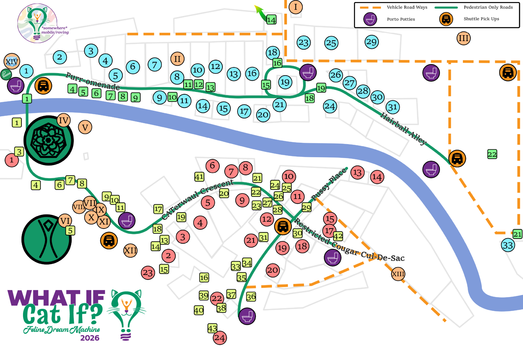
Download this image to your mobile device for ease of reference.
What If Map 2026
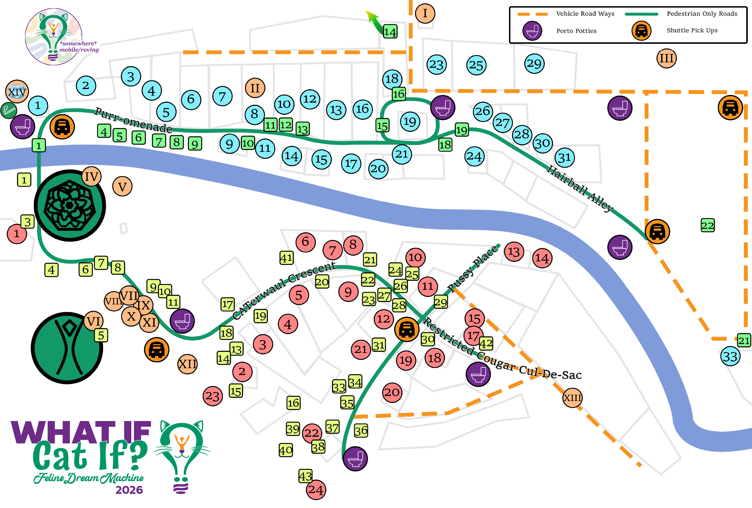
What If 2026 Participant Map IS HERE!
Much gratitude to this year’s map designer HighChew, who has lovingly designed our Participant Site Map.
- There will be PLENTY of professionally printed copies ready to be handed to you at Gate – make sure to get one!
- Several large scale maps will also be on display in a few strategic spots on site. Save your ink toner & get one at Gate!The map will be provided here as an easy to access image on your phone.
Download this image to your mobile device for ease of reference.
Or use the WWW/Dust app to take advantage of all of the interactive features!
❇️ SCOLL DOWN TO BOTTOM OF PAGE DOWNLOAD SECTION
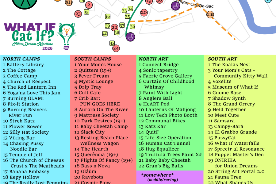
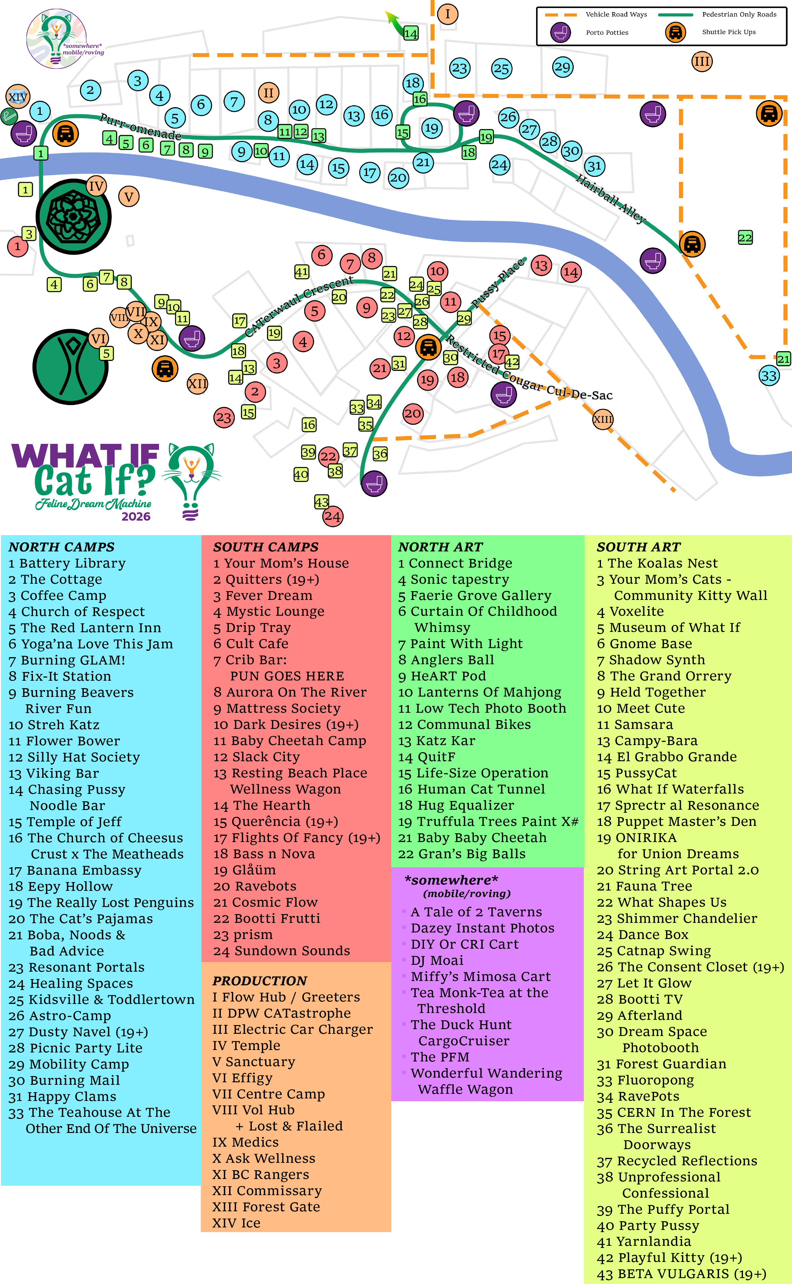
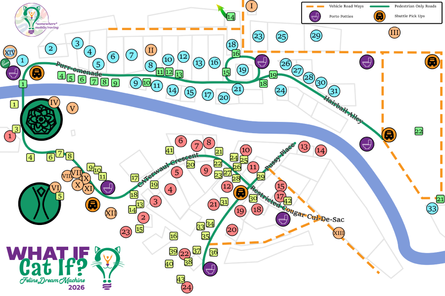
[FULL MAP with legend & Map Only versions available]
🖱️ COMPUTER: RIGHT CLICK to save
📱 MOBILE PHONE: LONG PRESS to save
♦ DOWNLOAD THE FULL MAP HERE ♦
![Download this image to your mobile device for ease of reference. What If Map 2026 What If 2026 Participant Map IS HERE! Much gratitude to this year’s map designer HighChew, who has lovingly designed our Participant Site Map. There will be PLENTY of professionally printed copies ready to be handed to you at Gate – make sure to get one! Several large scale maps will also be on display in a few strategic spots on site. Save your ink toner & get one at Gate!The map will be provided here as an easy to access image on your phone. Download this image to your mobile device for ease of reference. Or use the WWW/Dust app to take advantage of all of the interactive features! ❇️ SCOLL DOWN TO BOTTOM OF PAGE DOWNLOAD SECTION [FULL MAP with legend & Map Only versions available] 🖱️ COMPUTER: RIGHT CLICK to save 📱 MOBILE PHONE: LONG PRESS to save ♦ DOWNLOAD THE FULL MAP HERE ♦](https://whatif.now/wp-content/uploads/sites/14/2026/07/WhatIf2026Map5.png)